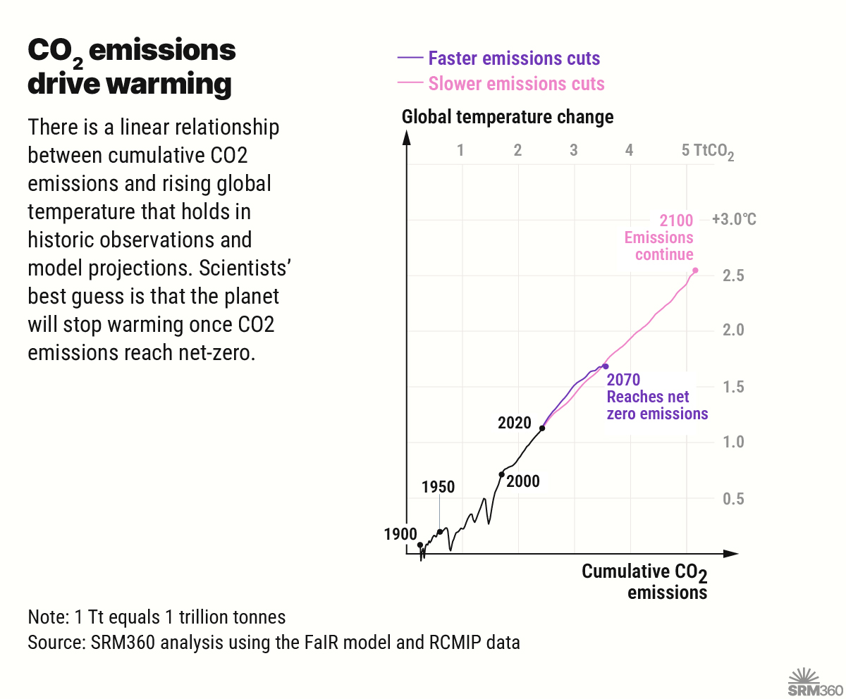
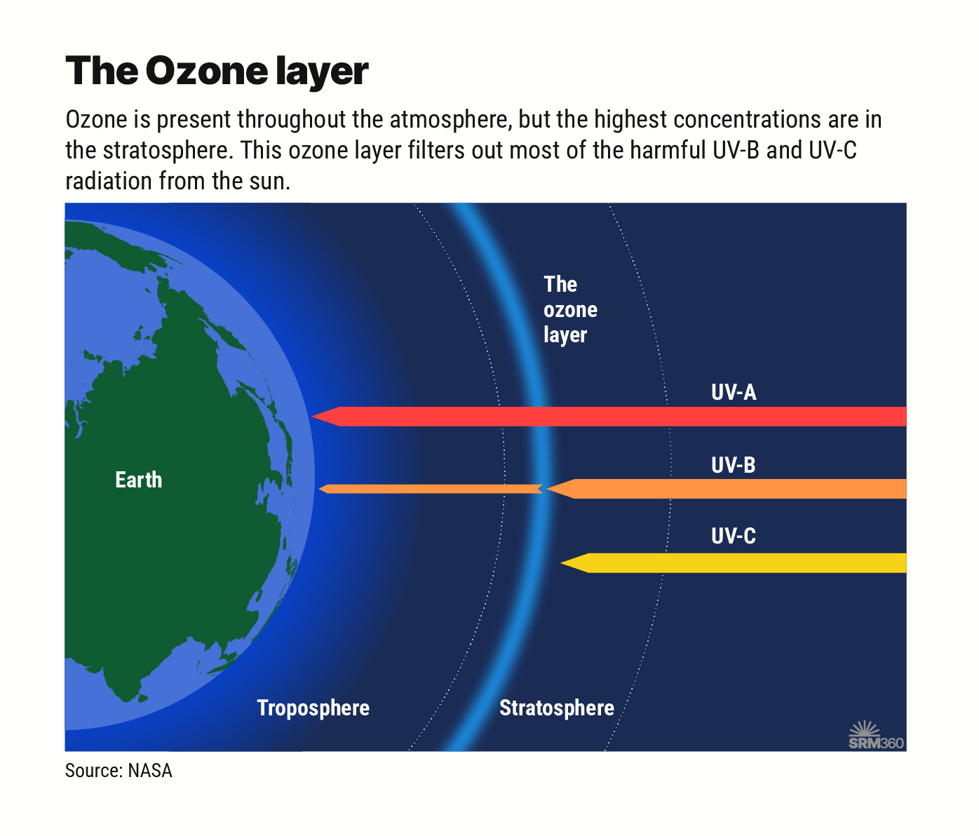
Graphic
Arctic sea ice extent
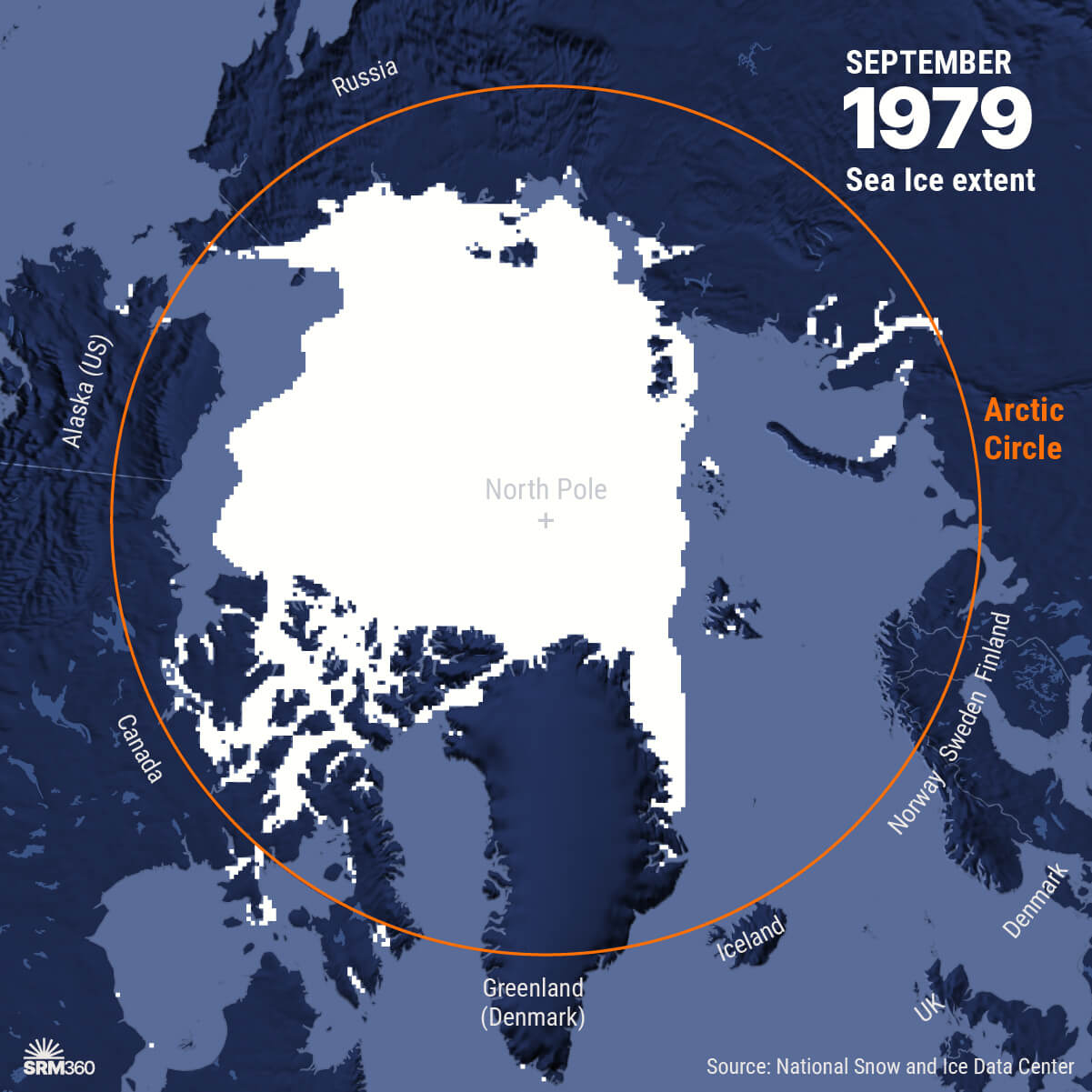
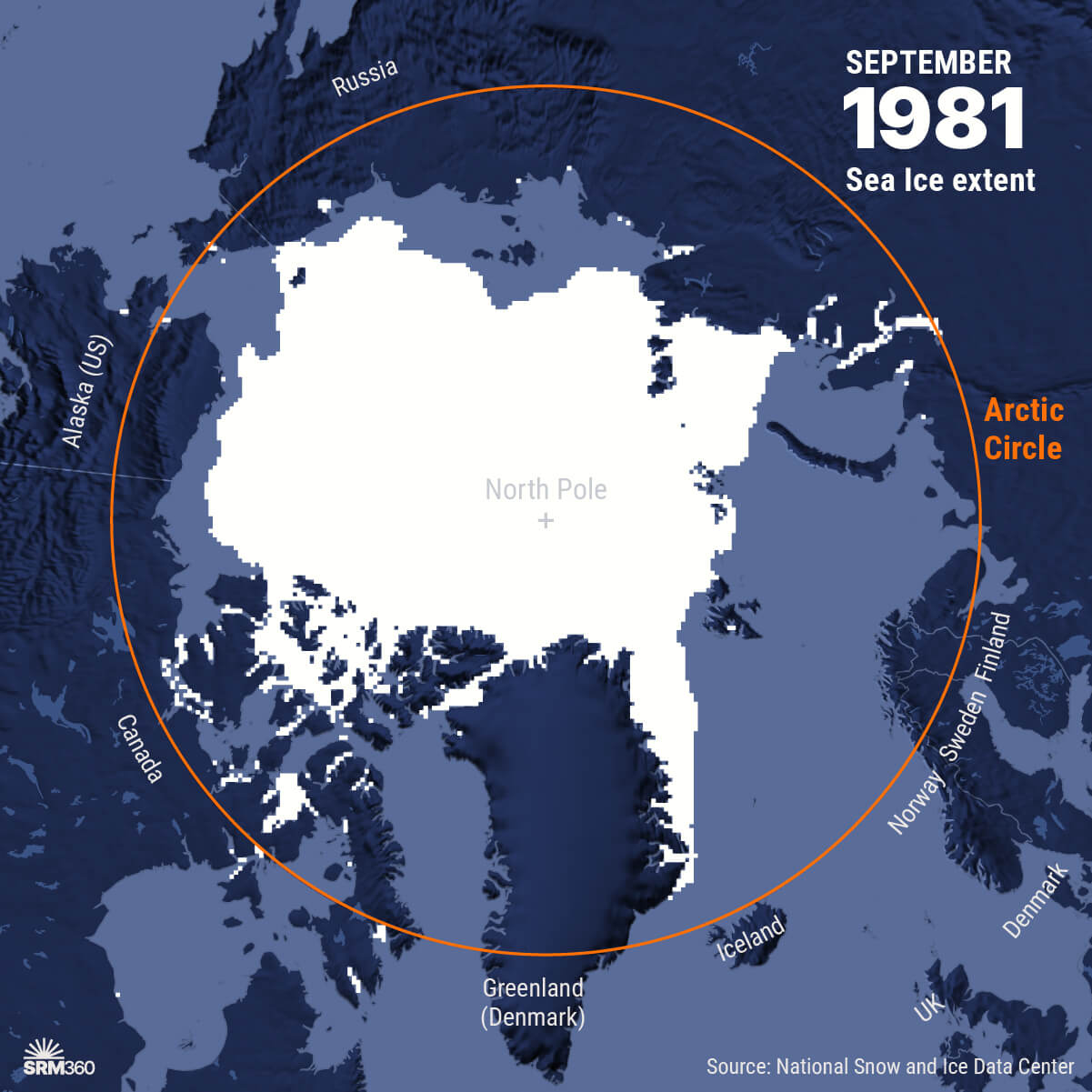
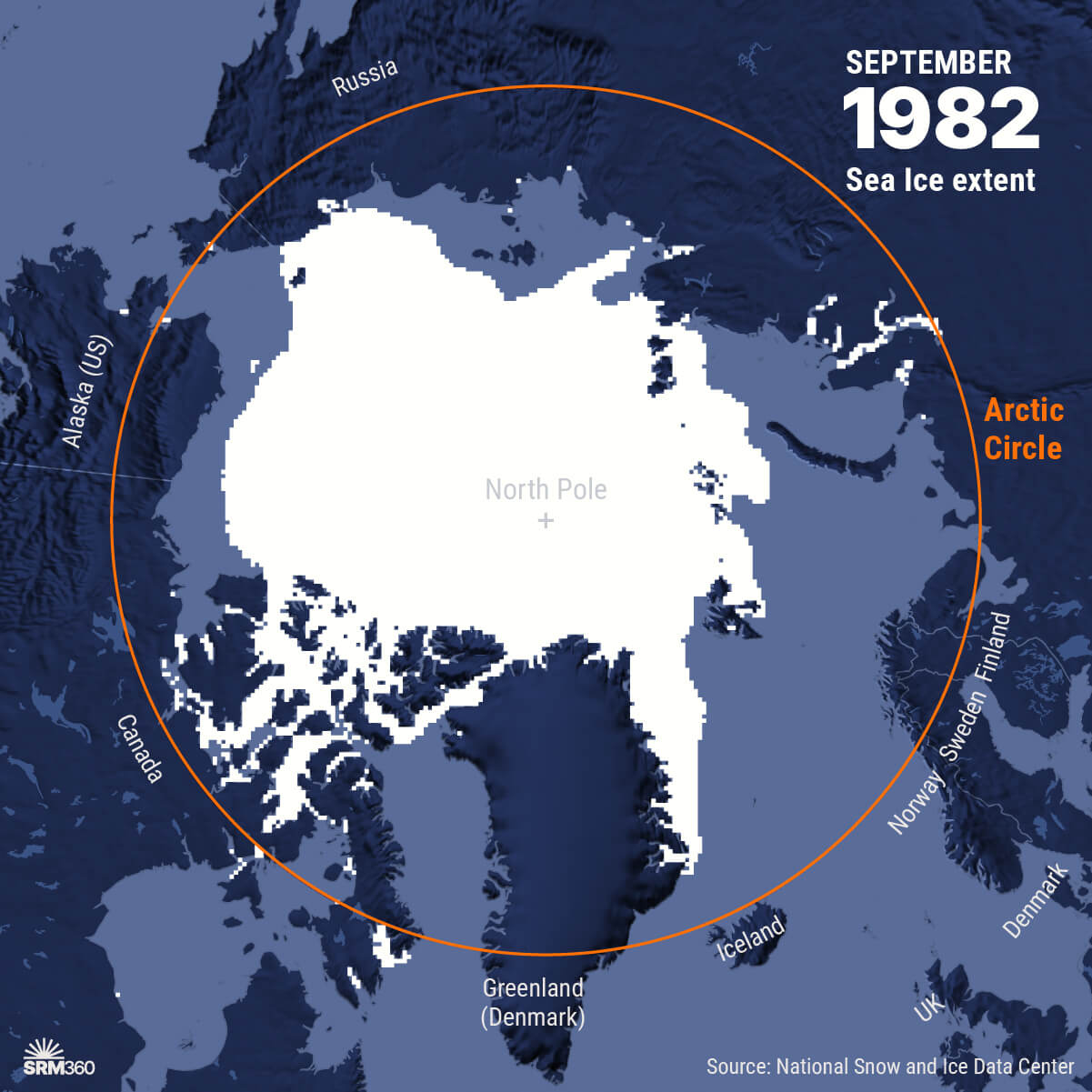
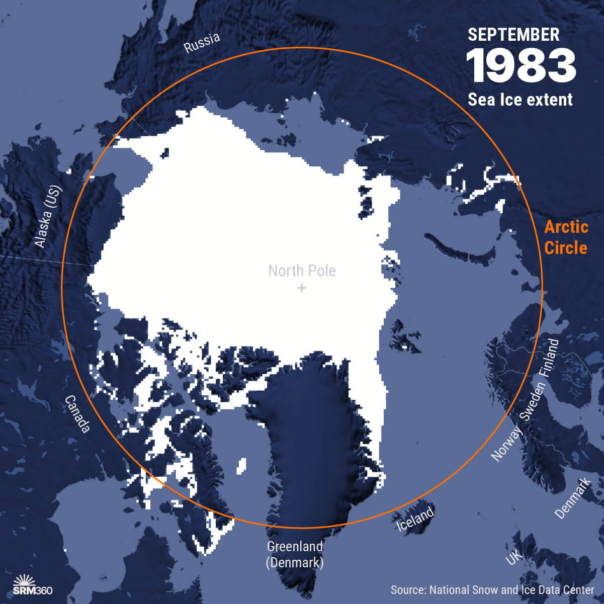
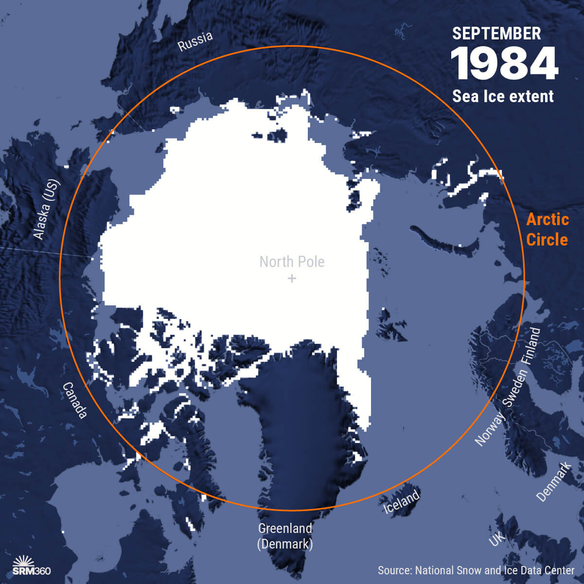
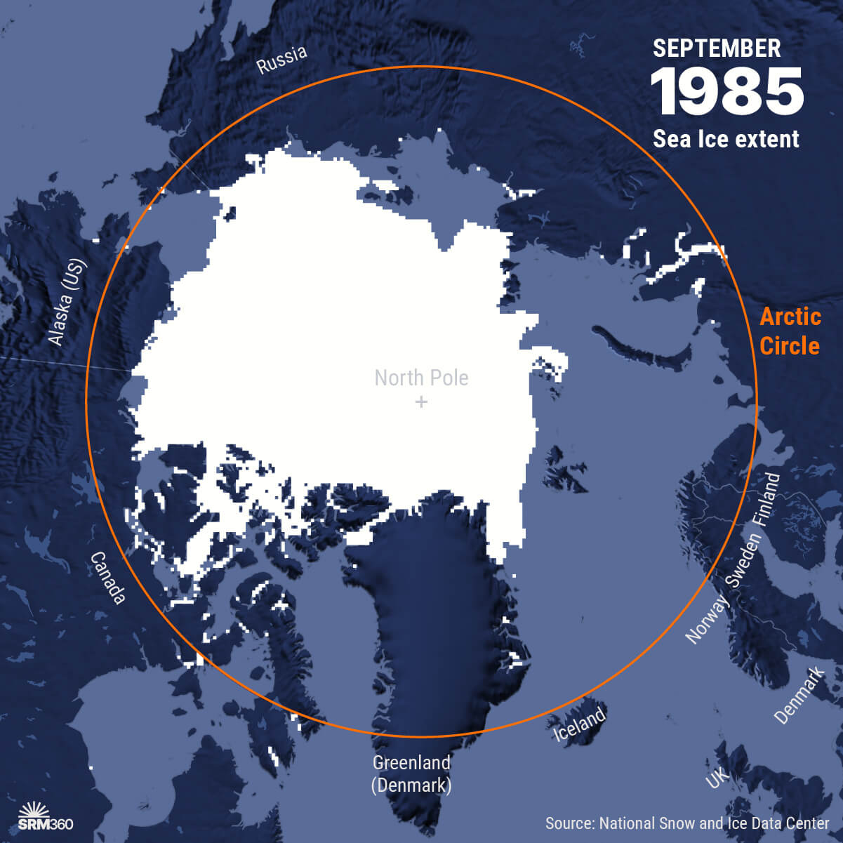
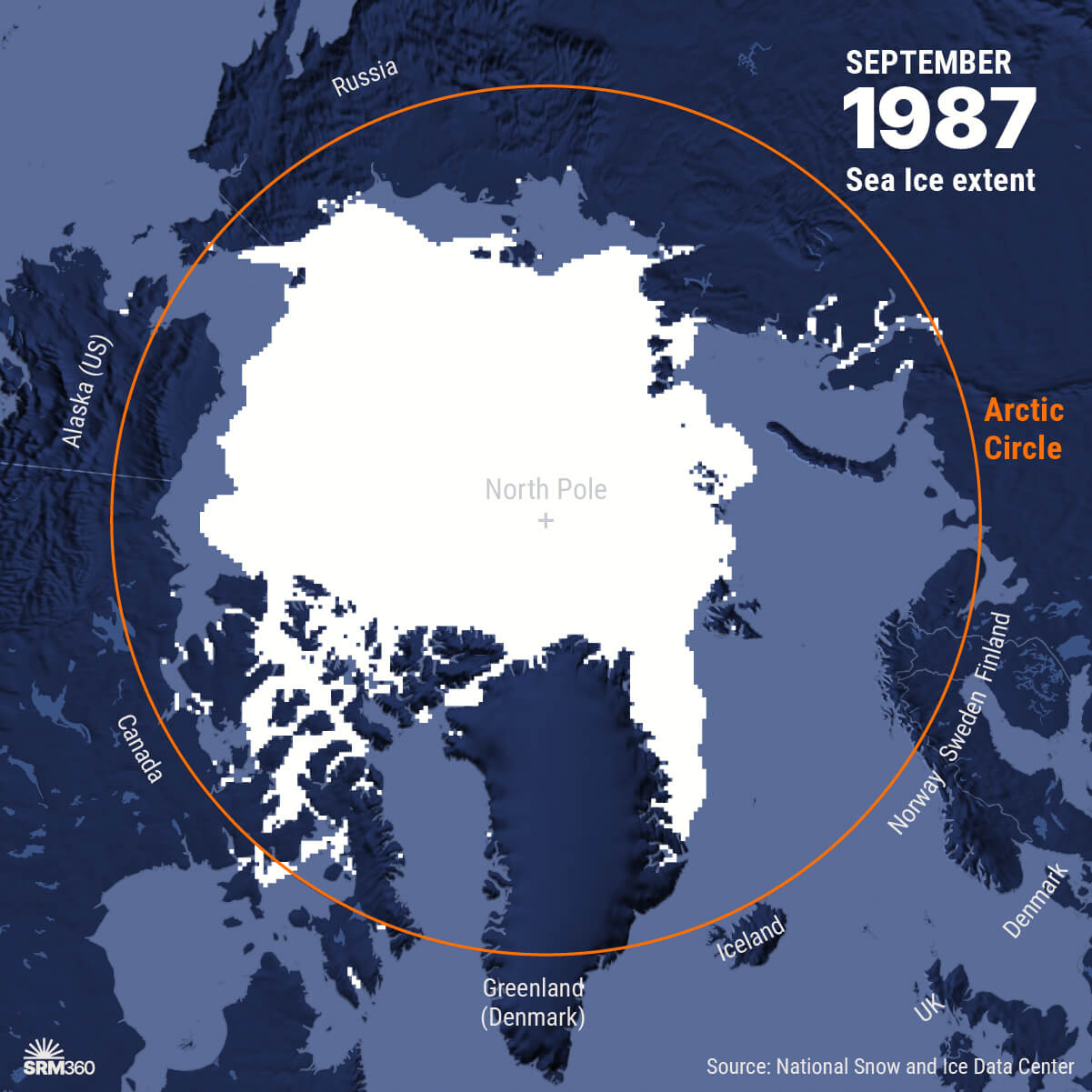
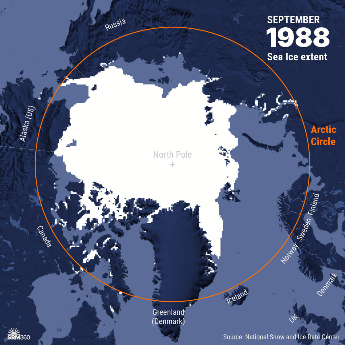
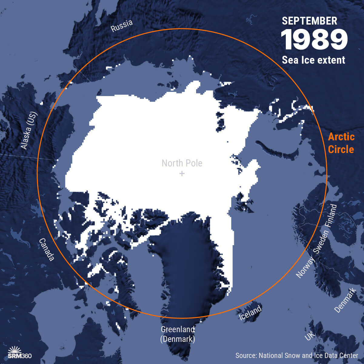
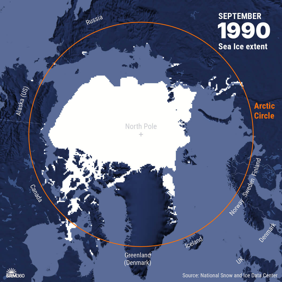
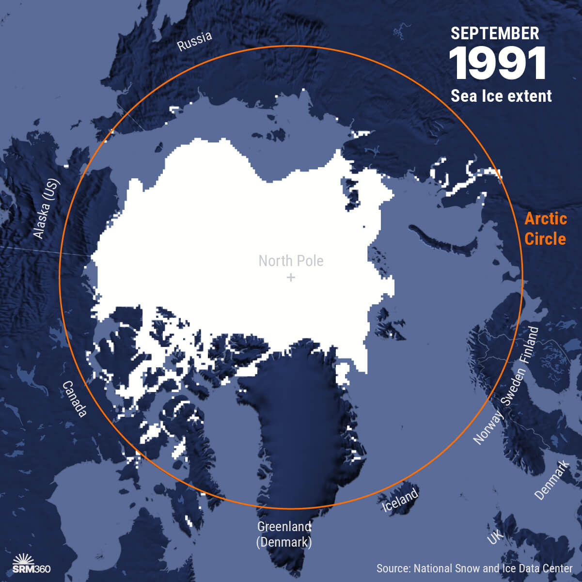
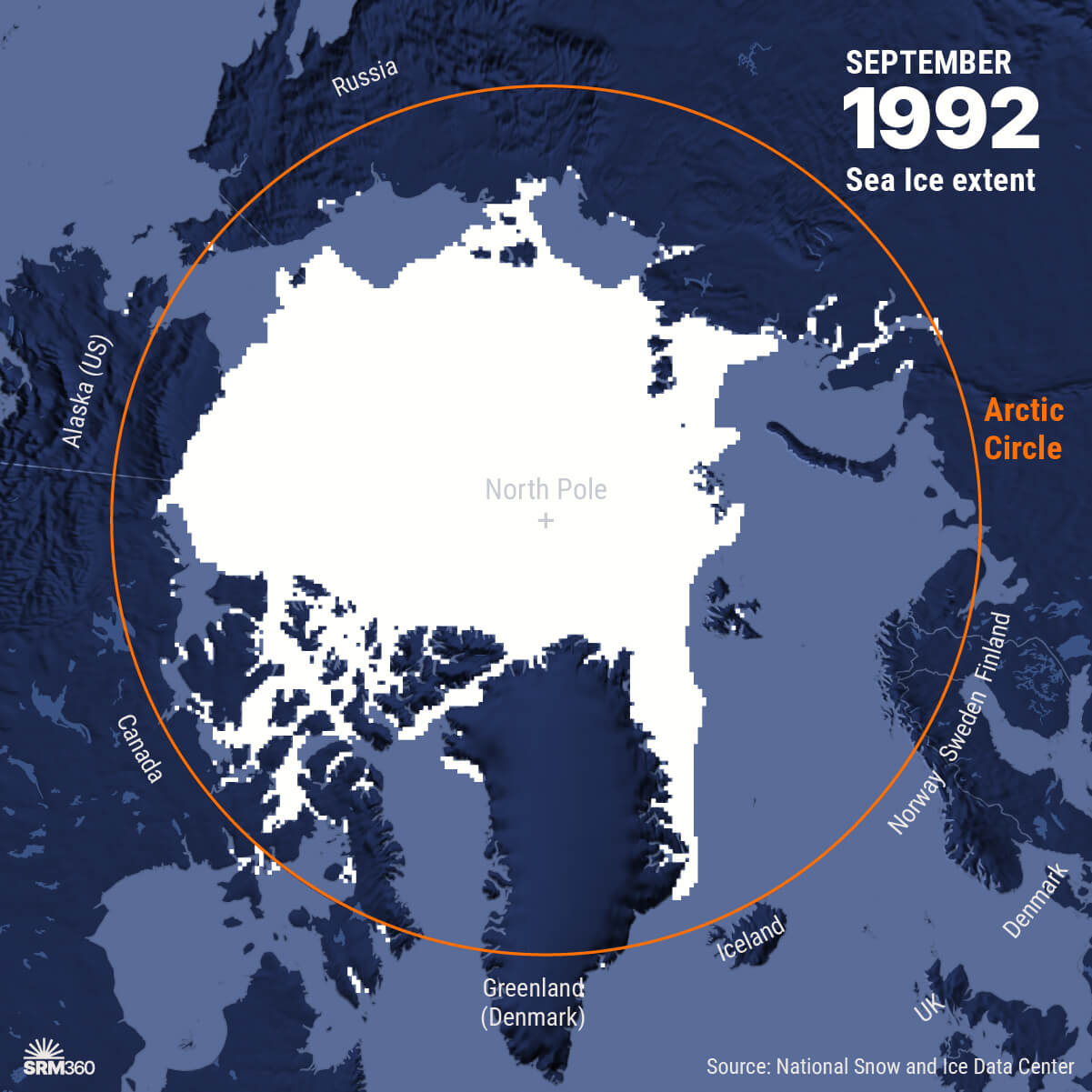
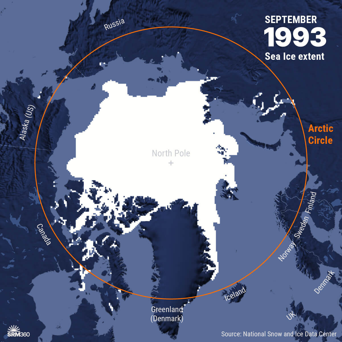
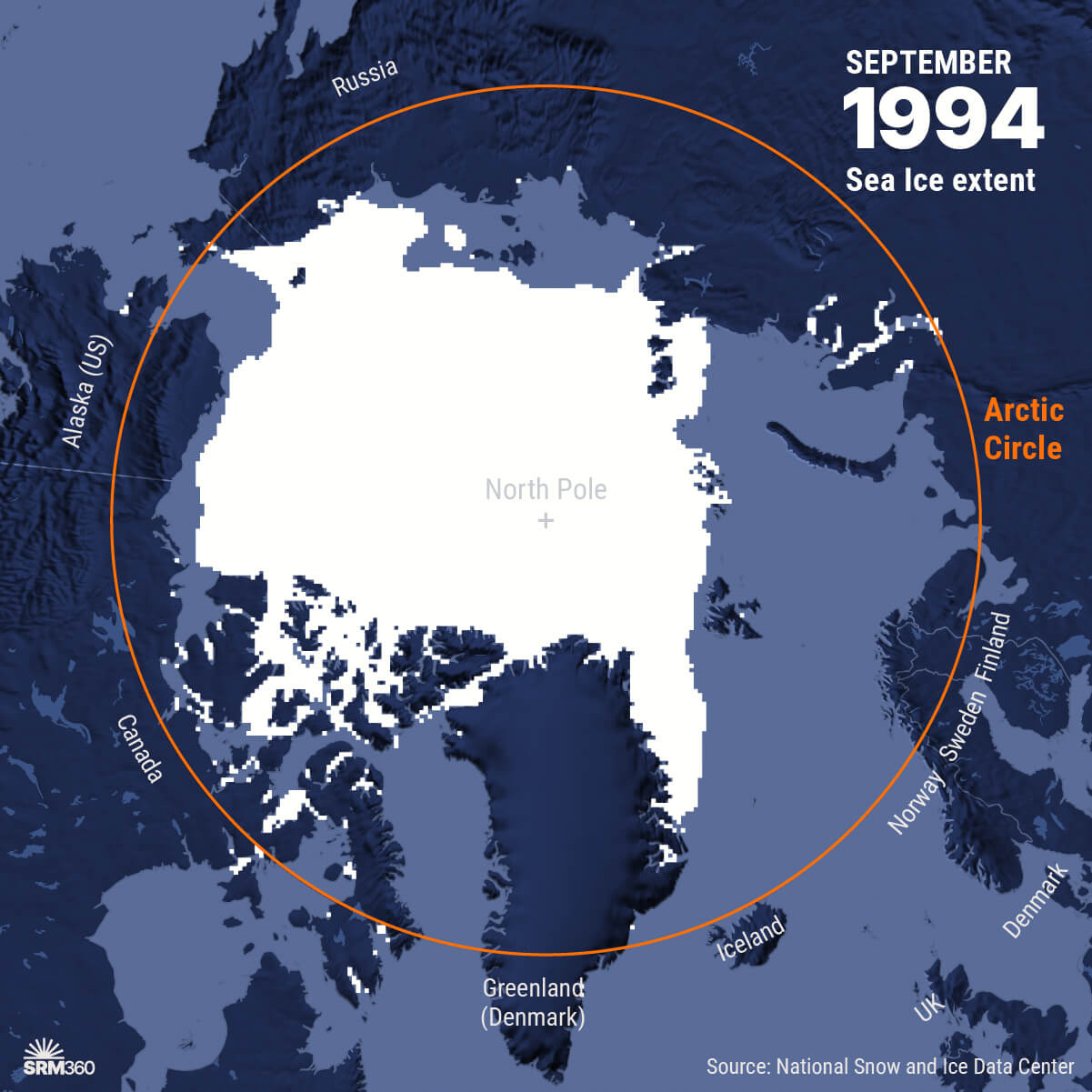
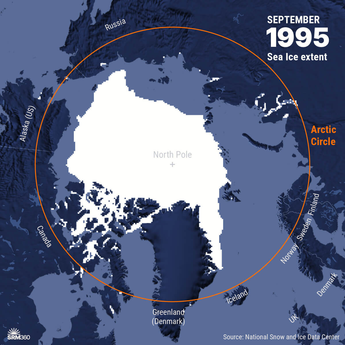
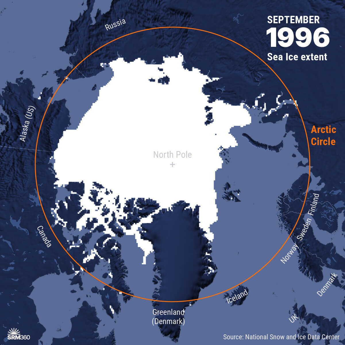
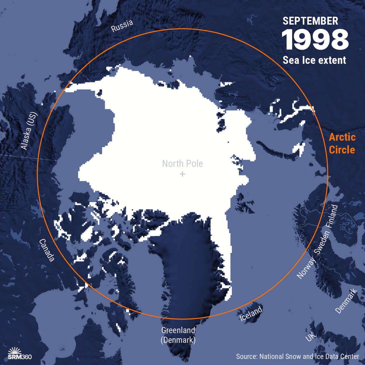
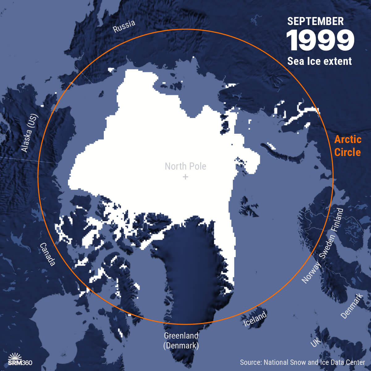
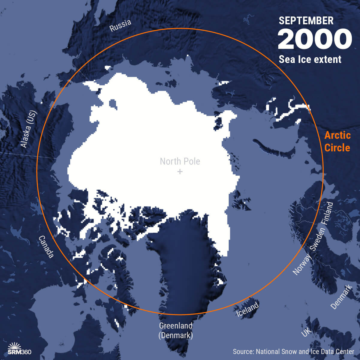
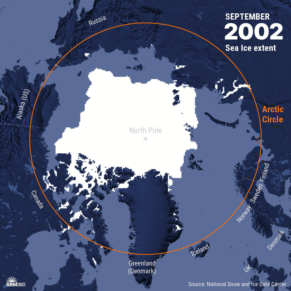
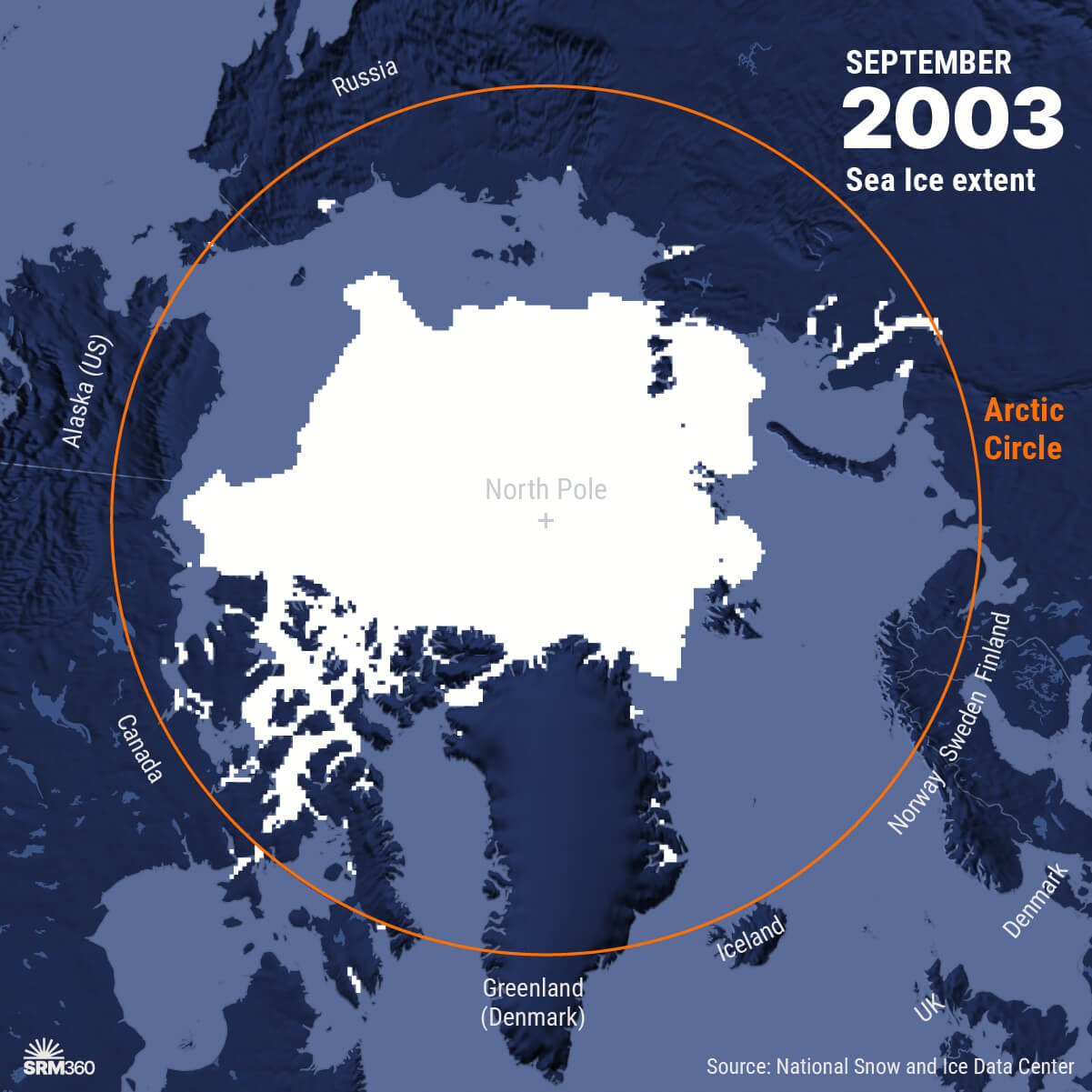
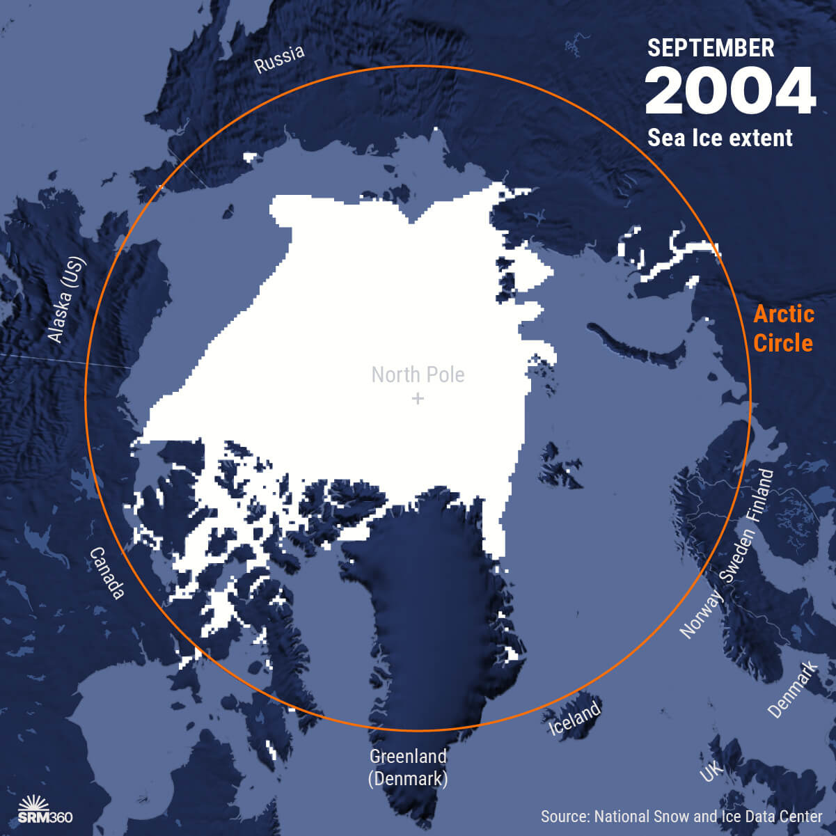
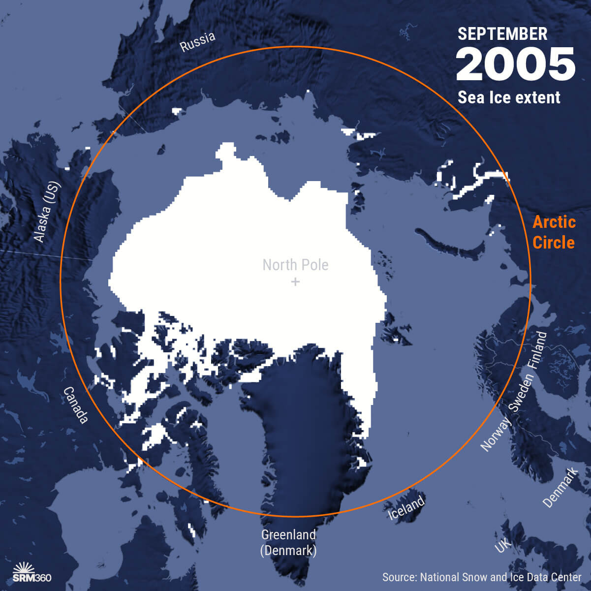
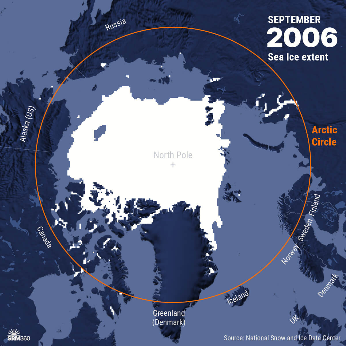
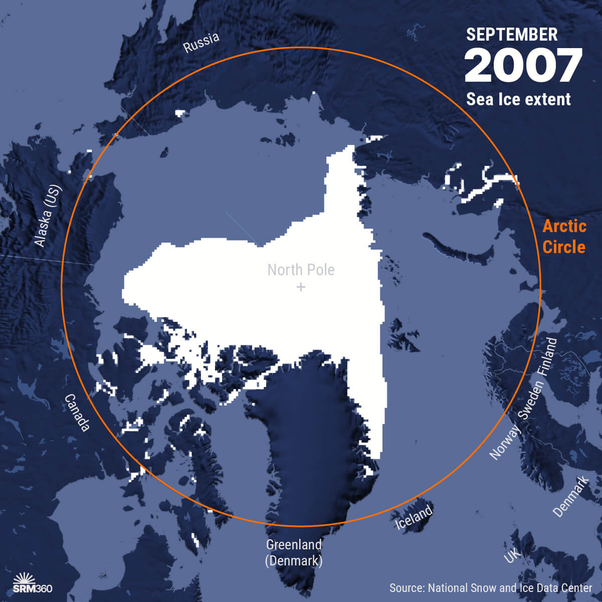
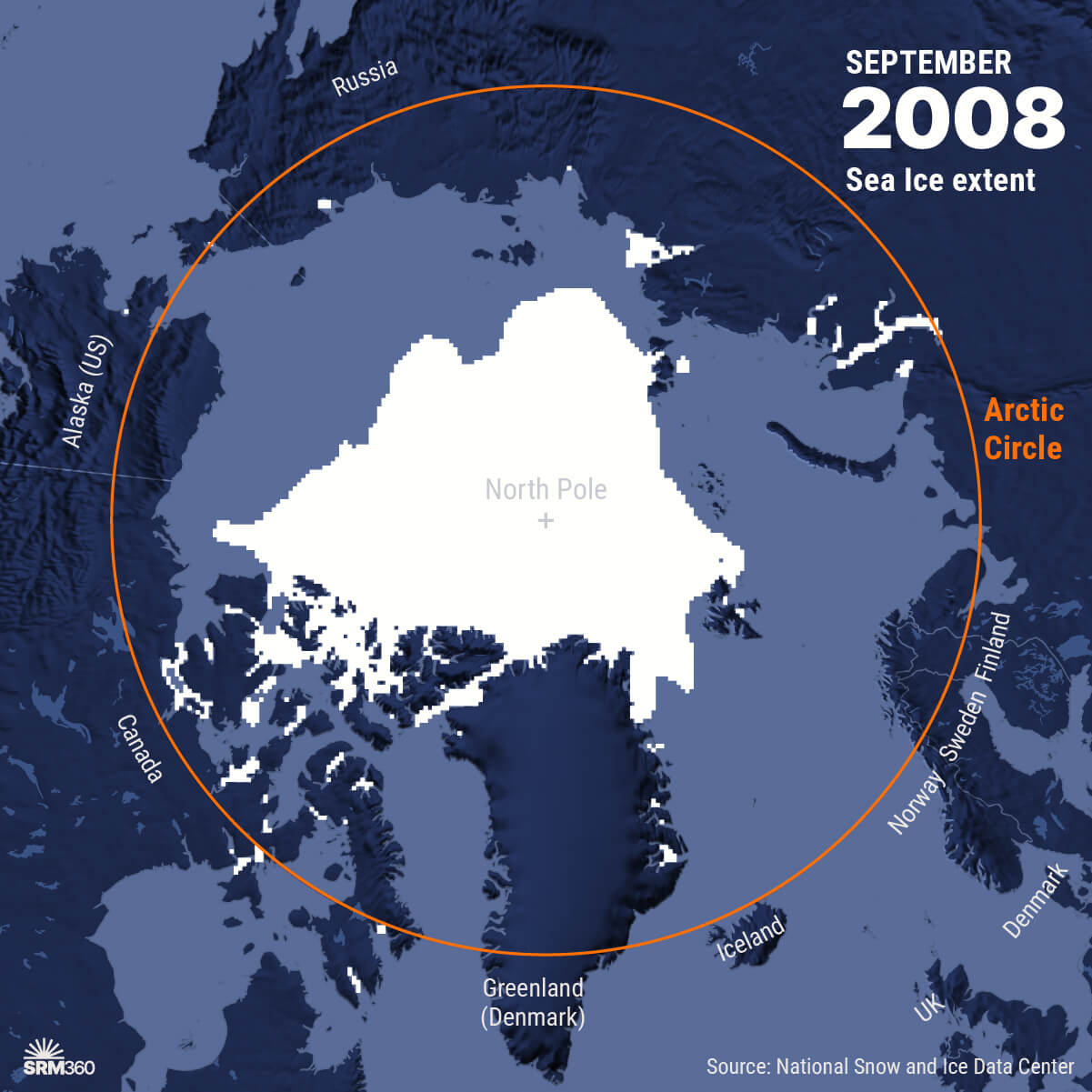
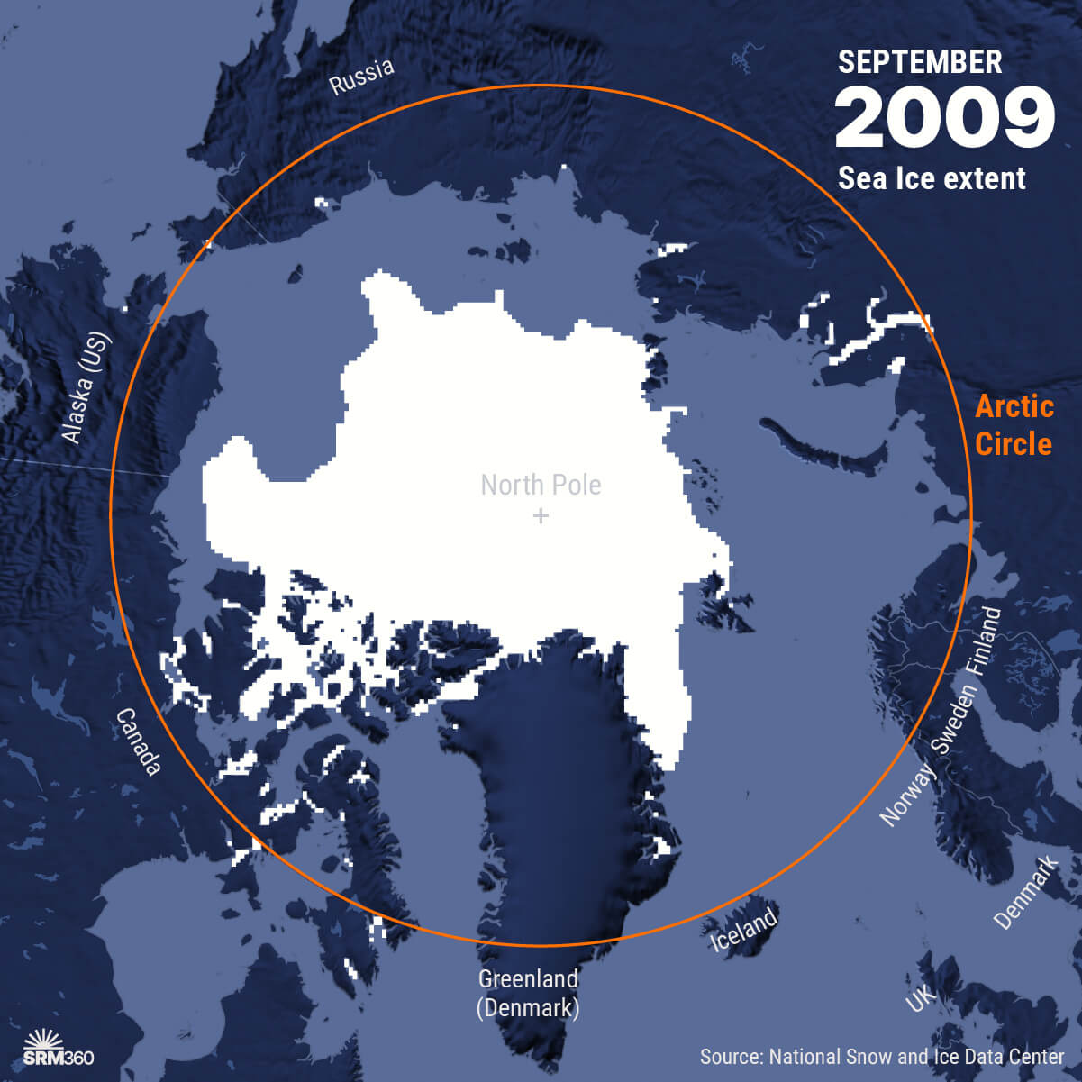
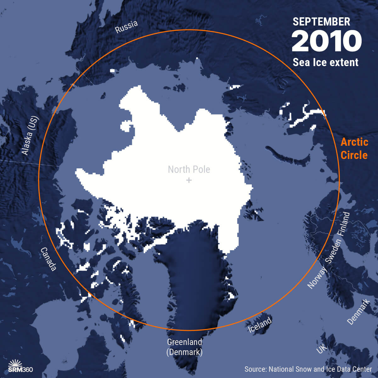
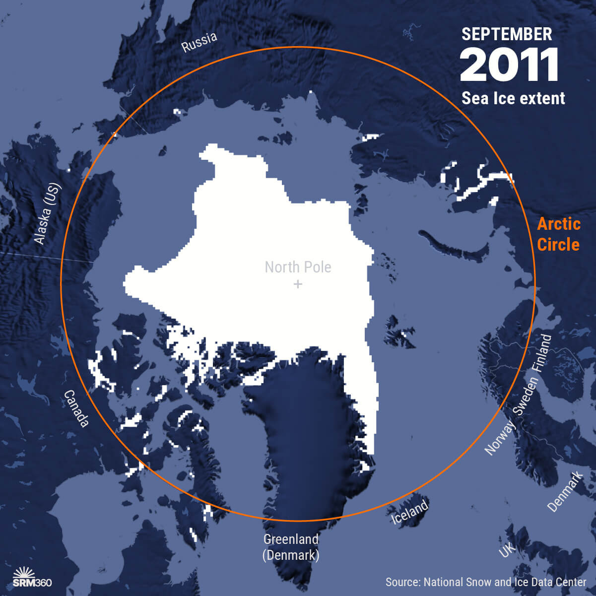
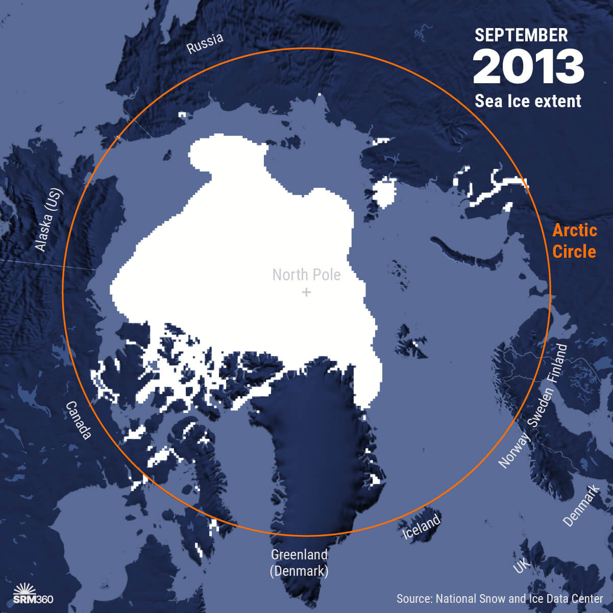
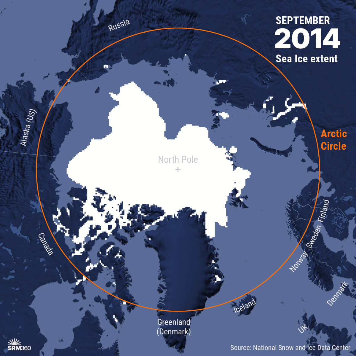
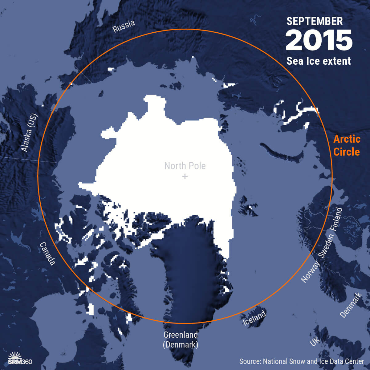
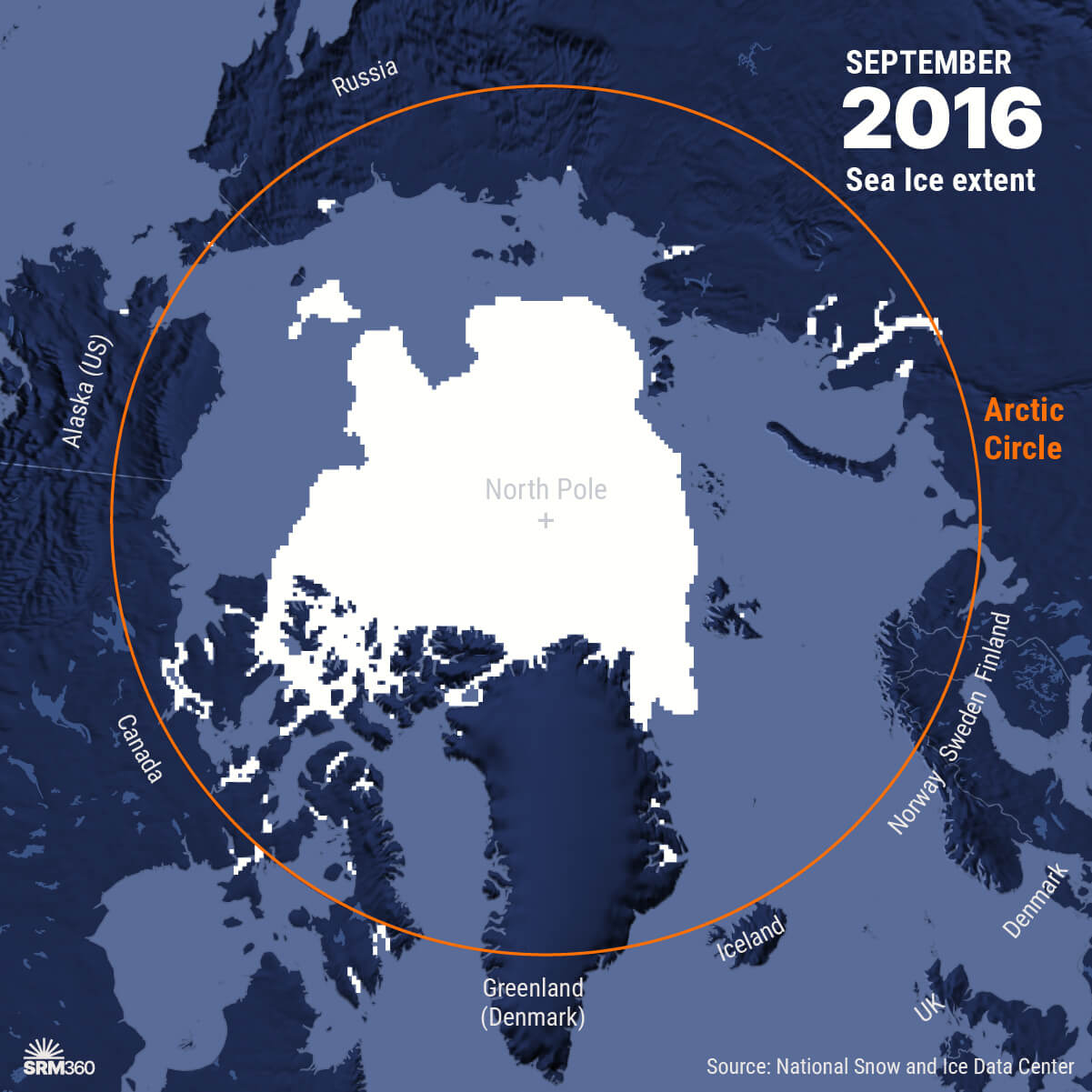
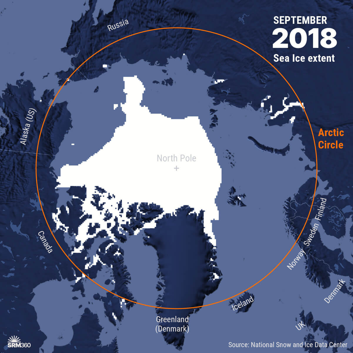
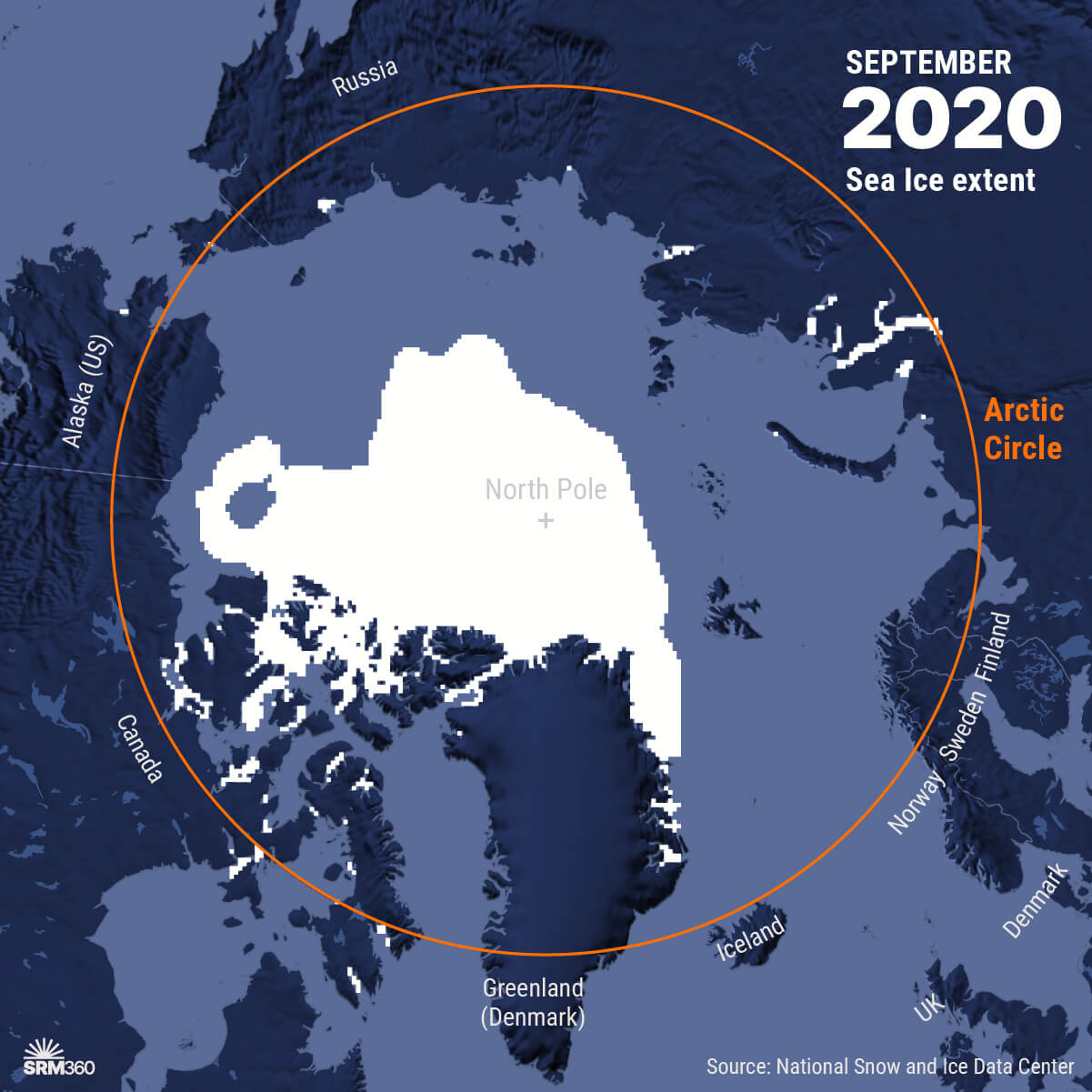
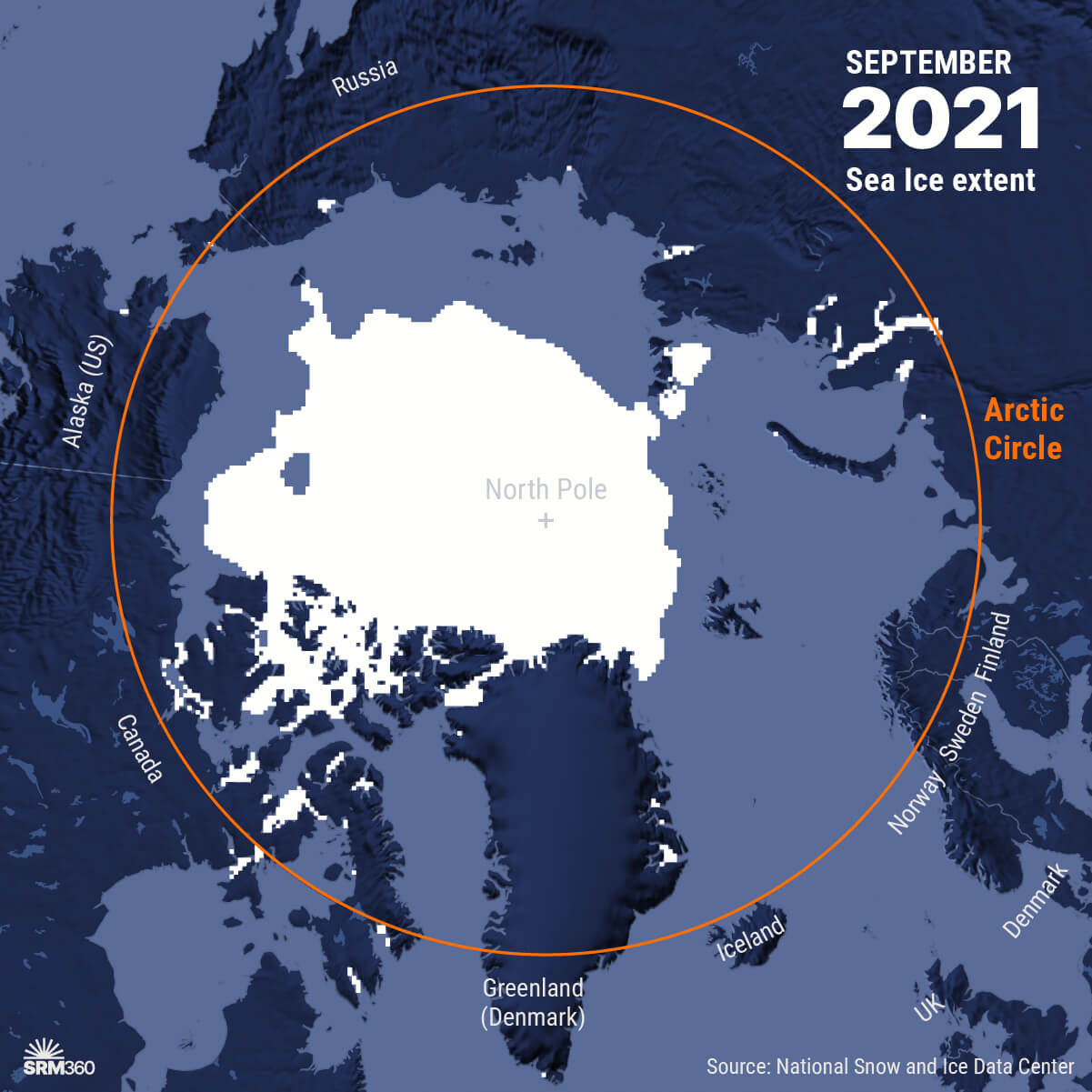
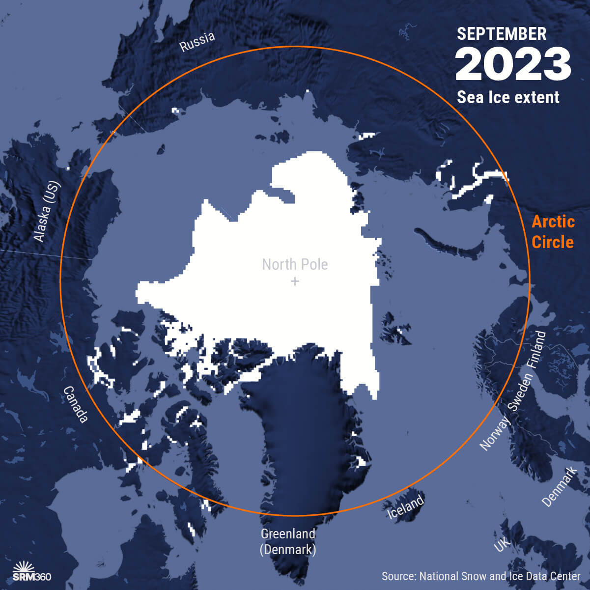
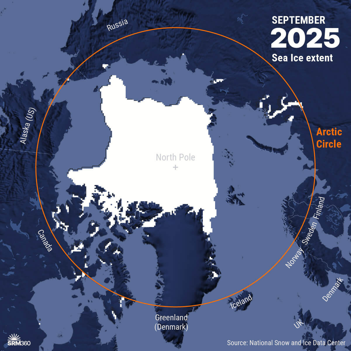
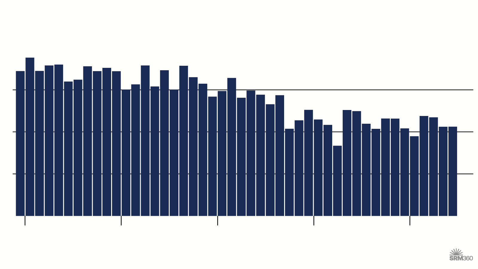
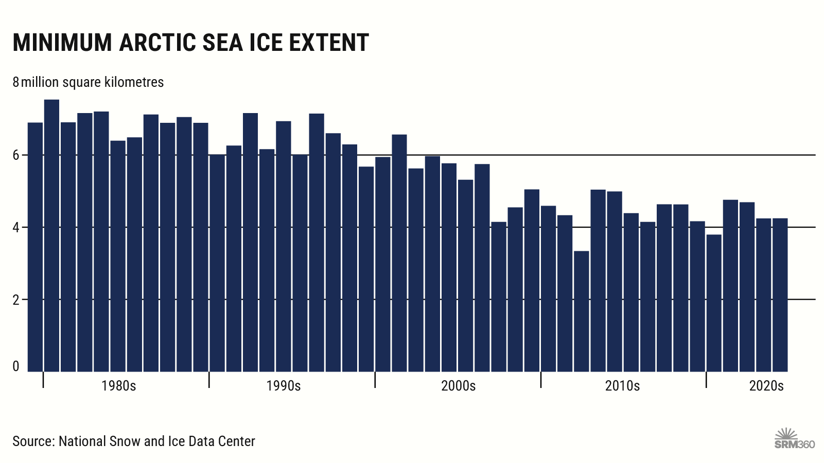
Arctic sea ice melts each summer, typically reaching its minimum extent in September. This graphic shows the September sea ice minimum for each year since 1979:


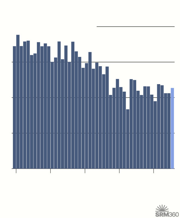
Minimum arctic sea ice extent
8
million square kilometres
6
4
2
0
1980s
’90s
’00s
’10s
’20s
Source: National Snow and Ice Data Center
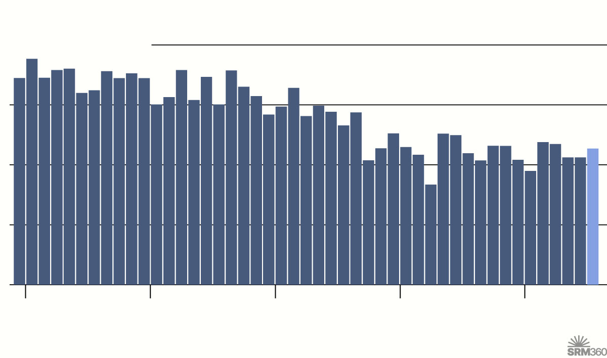
Minimum arctic sea ice extent
8
million square kilometres
6
4
2
0
1980s
1990s
2000s
2010s
2020s
Source: National Snow and Ice Data Center
Minimum arctic sea ice extent
8
million square kilometres
6
4
2
0
1980s
1990s
2000s
2010s
2020s
Note: 2025 is preliminary.
Source: National Snow and Ice Data Center

Citation
SRM360
(2025) – "Arctic sea ice extent" [Infographic]. Published online at SRM360.org. Retrieved from: 'https://srm360.org/infographic/arctic-sea-ice-extent/' [Online Resource]